I may receive a commission from a purchase. See more details here.
- TexyHills
- More Maps
Texas Hill Country maps
Texas Hill Country Maps are what truly unlocks the secrets of one of the most beautiful regions in the United States. This is the Texas Hill Country!
You are about to discover a luxury travel experience that rivals any European getaway.
These maps are not just lines on a paper or screen; they are your golden ticket to a perfect outing. They help you visualize the distance between a secluded cabin and a world-class vineyard.
It all starts with the right visual guide.
Check Out the Details
- The upper right icon will open the map into a full screen view.
- Box options on the left can then be checked or unchecked.
- The down arrow of each section will open up additional information.
- And clicking on individual icons on the map will pop up even more information.
- All TexyHills maps operate in the same way, with zoom and drag, and click to open information, including website links and photos on most locations.
- If your intended destination isn't listed or apparent on the map, type the name in the search bar to locate it.
The TexyHills map above is what I refer to as the Hero Map. It's the one to use if you need relative locations of towns, wineries and hotels, all on the same map. It contains all (or most) of the data in my other maps of the Hill Country.
You can also find additional information about my maps here.
But if you need only wineries, for instance, you may not want all the extra data to confuse things. In that case, try one of these less cluttered maps.
- Map showing only Restaurants.
- Map with only Lodging.
- Only towns on this map.
- Wineries and Vineyards on this one.
- A Lakes map.
- A map with Points of Interest.
Using maps to plan
Planning a trip here can feel overwhelming because there is so much to see.
A detailed Map of the Texas Hill Country simplifies everything for you. You can instantly see relative distance and location of towns and how they connect.
You don't want to waste your precious vacation time driving aimlessly on the highway. Instead, you want to pinpoint the exact B&B or winery.
Using a map ahead of time allows you to cluster your activities efficiently.
 View from the back seat of a well planned trip.
Then when you're on the road, just update your navigator for destinations as you go.
Piece of cake.
You can plan a morning hike, a lunch at a gourmet bistro, and an afternoon wine tasting, all within a short drive of each other.
It turns a chaotic schedule into a relaxing, well-ordered adventure.
drives that make texyHills famous
This map highlights the legendary Willow City Loop.
This narrow, winding ranch road is a must-see, especially during wildflower season. You will drive past deep canyons and tall cliffs that will take your breath away.
In the spring, the fields explode with bluebonnets and Indian paintbrushes. It feels like you are driving through a painting. It offers the kind of quiet, scenic landscape that recharges your soul.
Without a map to guide you to the entrance, you might drive right past this hidden gem.
The River Road Drive
Another route you need to find is the River Road along the Guadalupe River.
It runs between New Braunfels and Canyon Lake.
Tall cypress trees line the riverbanks and create a tunnel of green shade. The water sparkles under the Texas sun, inviting you to stop for a picnic or a quick swim.
It is a fantastic change of pace from the hustle of city life.
Texas Hill Country Maps highlight these scenic corridors so you can choose the most beautiful path, not just the fastest one.
You get to enjoy the journey just as much as the destination.
Highway 290 Wine Road
For many travelers, the Hill Country means one thing: world-class wine. The region is the second most visited wine destination in the country.
A good Texas Hill Country map guide is essential for navigating the famous Highway 290 Wine Road. This stretch near Fredericksburg is packed with incredible vineyards and tasting rooms.
You can use your map to plot a course of tastings or tours for the day. Select the order of wineries to visit for smooth travel. And locate the out-of-the way wineries like Becker Vineyards, that sits off of the main highway.
You can sip, relax, and enjoy the luxury of a well-planned tasting tour, without worrying about what's next.
Long weekend instead of a day trip?
Finding the perfect place to sleep is crucial for a high-end experience. The lodging options here range from historic hotels to luxury resorts and private riverfront cabins. When you look at Hill Country maps, you can decide exactly what kind of vibe you want.
Do you want to be right on the Main Street of a bustling town, close to shopping and fine dining? Or do you prefer a secluded spot deep in the hills where you can see every star in the sky?
My weekend planner can help with that. It's an excellent do-it-for-me planning option.
Plan My Fredericksburg Wine Weekend in 30 Minutes
- 3-day Itinerary Templates (printable + fillable)
- Curated drive loops + Google Maps links
- Reservation plan + Plan B library
Maps give you the context you need to make the right choice. You ensure your accommodation fits your travel style perfectly. Remember... clicking on a map icon will open up more information on the location, with photos and websites in most cases.
And here is a map that can help you compare pricing.
Events and festivals all year
Special events and festivals happen all year round in TexyHills.
You might want to catch Oktoberfest in Fredericksburg or the Lavender Festival in Blanco. Maps help you coordinate your trip dates with these exciting local celebrations.
You can see where the events take place relative to your hotel. This helps you avoid traffic or find the best parking.
Whether you are attending a destination wedding or a food festival, knowing the lay of the land reduces stress. You can focus on celebrating and having a great time with your friends or partner.
Explore with texas hill country maps
You should also use your maps to explore the charming towns that anchor the Hill Country. San Antonio and Austin are major cities along the edge of TexyHills. And each one close enough to serve as your base for travel and exploration.
Places like Wimberley, Boerne, and Marble Falls offer unique shopping and dining experiences. Wimberley is famous for its swimming holes and artisan shops. Boerne boasts the "Hill Country Mile" full of boutiques and breweries.
A quick glance at Texas Hill Country Maps shows you that these towns are close enough for easy day trips. You can wake up in one town and eat lunch in another.
Each town has a distinct personality waiting for you to discover.
enjoy the outdoors
If you love outdoor recreation, the map points you toward natural wonders like Enchanted Rock. This massive pink granite dome offers hiking trails with panoramic views that go on for miles.
It is a bit remote, so knowing exactly where it is helps you plan your arrival time. You can beat the crowds and enjoy the peaceful morning air. As I recall, though, you can't just show up. You need to have a reservation.
Other spots like Hamilton Pool Preserve offer swimming in a collapsed grotto that looks like a movie set. Your map ensures you don't miss these spectacular landmarks. They provide the perfect backdrop for photos and memories.
What it's all about
Ultimately, a trip into the Hill Country is about slowing down and enjoying the good life.
You escape the noise and find a peaceful rhythm. The food is fresh, the people are friendly, and the views are unmatched.
By using Texas Hill Country Maps, you curate a vacation that fits your discriminating tastes. You avoid the tourist traps and find the authentic experiences.
You return home feeling refreshed and ready to plan your next visit. It is a luxury travel experience that stays with you long after you leave.
People also ask...
You might have some specific questions about navigating TexyHills. Here are some general questions that are frequently asked (FAQs).
What is the most scenic route in the Texas Hill Country?
What is the most scenic route in the Texas Hill Country?
Most people agree that the Willow City Loop and the River Road are the top choices for scenery. Although, Park Road 4 is a good one too.
What are the major cities in the Texas Hill Country?
What are the major cities in the Texas Hill Country?
The main gateways are Austin and San Antonio, but the key Hill Country towns are Fredericksburg, Kerrville, New Braunfels, Marble Falls and Boerne.
Do I need a car for Texas Hill Country?
Do I need a car for Texas Hill Country?
Yes, having a car is highly recommended because the attractions are spread out and public transport is limited between towns.
What is the best time of year to visit?
What is the best time of year to visit?
Spring (March to May) is best for wildflowers, and Autumn (October to November) offers great weather and wine festivals. But really... anytime is great! It's year-around fun.
think ahead and keep on planning
If you just get in the car and go for a drive to enjoy the scenery, you may not need to plan much (except for remembering to take your phone, ID and some cash).
But if your plans will include a girls' weekend or full blown wedding, a little thinking ahead is a must.
I understand your level of planning will vary depending on how elaborate and involved you want your trip. So, maybe these resources will help you decide what level of planning you want.
- TexyHills Checklist - A short 1-page list of 10 things to book first, for a smooth weekend. Yours free when you sign up for the TexyHills Fan Newsletter.
- TexyHills Planning Guide - An easy quick-reference to help you think about when to visit, getting around, avoiding big crowds, etc.
- Ultimate Texas Hill Country Guide - A much more comprehensive guide including maps, itineraries, where to stay, etc. It also has a table of contents for easy navigation.
- Fredericksburg Wine Weekend - My most complete done-for-you 3-day plan, reservation strategy, and curated drive loops (with a built-in Plan B). Specifically for first-timers.
What's New?
-
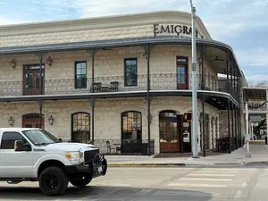
Vaudeville Bistro will cause you remember why you love to travel.
 Vaudeville Bistro sits right on Main Street in the middle of Fredericksburg, Texas. It coaxes you slow down, take a deep breath, and feel glad you're here.
 -
Horseshoe Bay Resort is your dream getaway of Texas beauty and luxury.
Horseshoe Bay Resort covers thousands of acres, one of the largest resort properties in Texas. Sitting on Lake LBJ, you have your pick of 4 golf courses. -
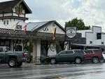
Fredericksburg Texas Restaurants - Flavor of the Texas Hill Country
Fredericksburg Texas Restaurants - Experience the aroma, flavor, and ambience of the Texas Hill Country. Pick your style, sit back, and take it all in. -
Hill Country Travel Guide is for preventing unexpected situations.
Hill Country Travel Guide gets you thinking about your routes, budget, activities, weather, crowds, traffic, etc. so you don't run into anything unexpected. -
Fredericksburg Texas Lodging is so widely varied that everyone wins.
Fredericksburg Texas Lodging puts you in the middle of wine country. You also get the benefit of the history, comfort and convenience of your surroundings.


Brought to you courtesy of jeff slankard
 with wife Judy at Wildseed Farms") Daughter Ranita with Shane, and me (Jeff) with wife Judy at Wildseed Farms
Daughter Ranita with Shane, and me (Jeff) with wife Judy at Wildseed FarmsJeff Slankard is a Texas Hill Country writer with a master’s degree in Education and a longtime focus on the region’s wineries, restaurants, and travel experiences. He has lived in the Hill Country for 35 years, explored dozens of towns and even more wineries and restaurants, and documents those experiences at TexyHills.com. Jeff is also a published e-book author on Amazon. His early experience brewing ale and fermenting wine still shapes how he thinks about winemaking and its taste.